Leninallee in Ost-Berlin
And Facing the Car
The 1960s marked the peak of Berlin’s transformation into a city for cars. The shadow of the Cold War meant that the planning and delivery of transport was done without much fanfare in either East and West. Despite the low number of cars, East Berlin’s transport specialists were planning for a future that brimmed with automotive travel. Leninallee, now Landsberger Allee, was the most demonstrably car friendly road in East Berlin. Its name – Leninallee – underscored its extraordinary significance, connecting the centre of East Berlin with Marzahn. It began at Leninplatz with towering buildings and a colossal statue of the road’s namesake. Leninallee offered and still offers an abundance of unused space. Indeed, at no point along its entire length might it be considered attractive to pedestrians. The buildings are mostly monofunctional, often appealing in isolation, but with little coherence or connection to the street. For example it is home to a landmark sport and recreation centre, the vast housing estates of Fennpfuhl and Marzahn, numerous shopping centres, furniture stores, and indeed the Marzahn Bock windmill.
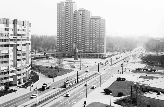
Leninplatz, now Platz der Vereinten Nationen [United Nations Square] with the Lenin Monument and residential buildings in Berlin, 16th April 1980
The street has six lanes, but few cars. The spacious square is very open.
A Grand Opening: Leninplatz
Leninplatz was highly regarded as an example of exceptional modern socialist urban planning. Since 1970, high-rise residential buildings and the imposing Lenin Monument had been highly visible landmarks on Leninallee, which stretched eleven kilometres. Leninplatz offered all the amenities of a residential area, boasting a post office, shopping centre and kindergarten, but the road was also a transport hub, tourist attraction, and meeting place for political rallies. In 1991, the square was renamed Platz der Vereinten Nationen [United Nations Square] and the Lenin Monument was removed. Today the square presents as a secluded grassy area, tucked between Volkspark and Strausberger Platz.
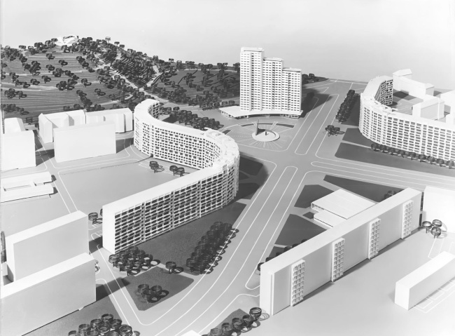
Model of Leninplatz, 1968
The residential buildings curve around the centre of the square in respective S and U shapes, symbolic of German-Soviet solidarity. The square was designed by a collective led by the architect Hermann Henselmann.
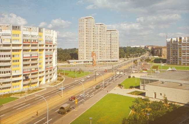
View of Leninplatz, probably 1970s
In the vast square, the colossal statue of Lenin holding his flag appears out of place and proportion while surrounded by a trickle of car and pedestrian traffic. The back of the statue bears a relief depicting German and Soviet workers shaking hands.
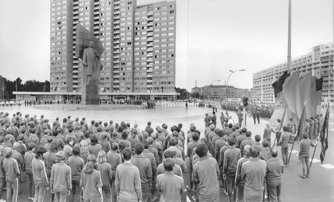
The Fourth Children’s and Young People’s Spartakiad in the GDR at Leninplatz, 1972
The area next to the Lenin Monument was a prestigious location for party and state political stagings and mass gatherings. The 19-metre-high monumental statue made of red granite was designed by the Soviet sculptor Nikolai Tomski.
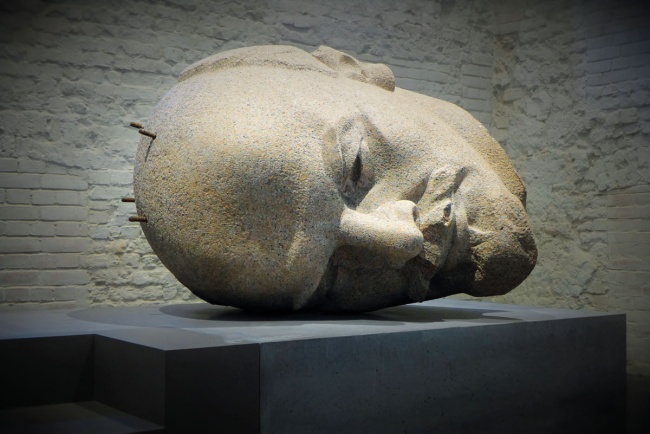
The head of the Lenin Monument in the Spandau Citadel Museum, 2016
Leninplatz was one of East Berlin’s primary tourist attractions. In 1991, the Lenin Monument was dismantled amid protests. Today, the grassy verge offers five fountains that spring from large rocks that symbolise the five continents. The decapitated head of the Lenin Monument is now installed in the Spandau Citadel Museum.
Avenue of Healthy Encouters
Numerous sports and recreational facilities were built along Leninallee. Constructed to the south of the street were the Werner-Seelenbinder-Halle (1950), and an outdoor swimming pool at Friesenstadion (1951). Added later, the Sport and Recreation centre (1981), and several additional sports facilities around Volkspark Friedrichshain. Lastly, there were sports halls and an indoor swimming pool built at Anton-Saefkow-Platz (1981), and an indoor swimming pool at Freizeitforum Marzahn (1989) added to serve the densely populated residential areas to the north of the avenue. The Werner-Seelenbinder-Halle and the Friesen-Schwimmstadion were demolished in the 1990s. The defunct SEZ sport and recreation centre will soon be destroyed.
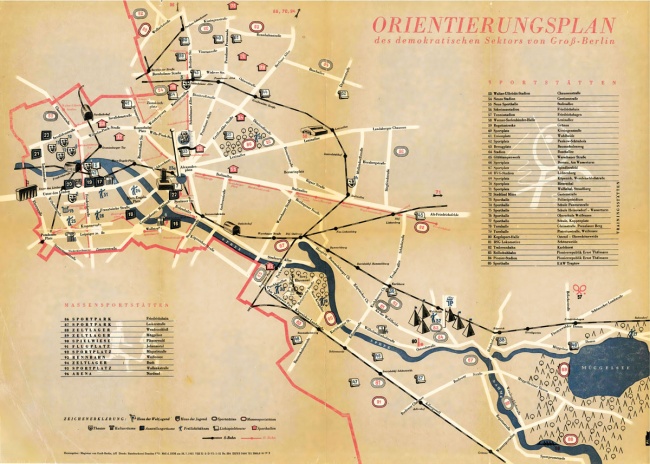
Plan of the sports facilities in East Berlin, 1951
As part of the “Third World Festival of Youth and Students”, East Berlin presented itself as a city of sport and culture. Seen on the map along Leninallee is the sports park in Volkspark Friedrichshain, the Friesen-Schwimmstadion, the Werner-Seelenbinder-Halle, and the BVG stadium in Lichtenberg.
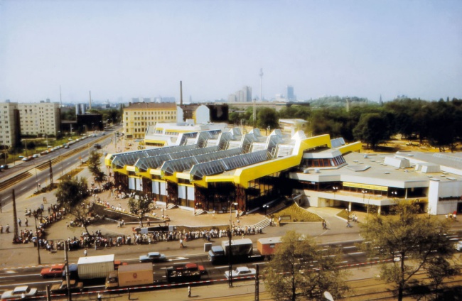
SEZ sport and recreation centre, 1990s
Opening in 1981, the SEZ at Volkspark Friedrichshain offered both swimming and leisure pools, a bowling alley, ice and roller-skating rinks, and other amenities. It closed in 2003. Demolition is planned in 2024 to build 500 apartments and a school.
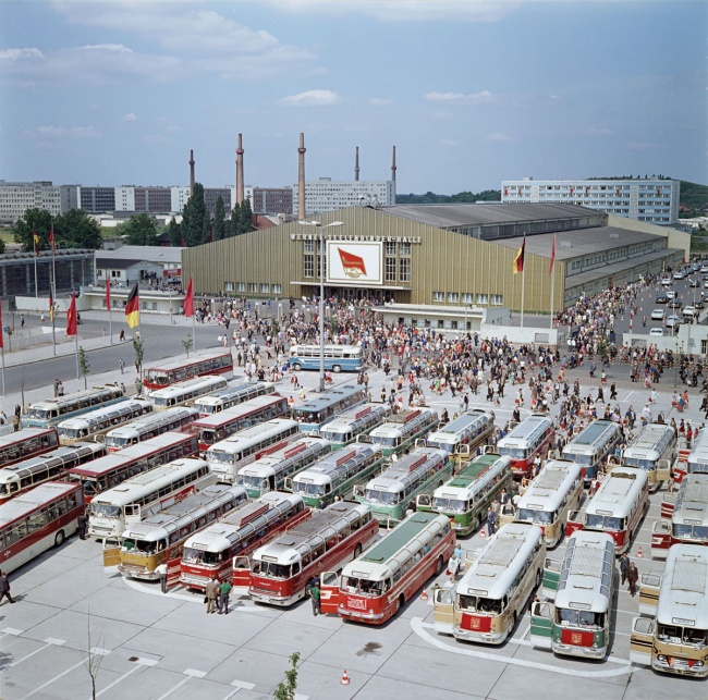
FDGB Congress in the Werner-Seelenbinder-Halle, 1972
The Werner-Seelenbinder-Halle was the central sports venue of the GDR and was often used for political events and concerts. The hall was demolished in 1992. In its place, the Velodrom and a combined swimming and diving centre were built.
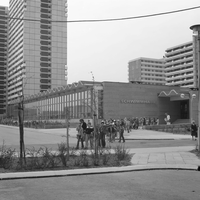
Indoor swimming pool at Anton-Saefkow-Platz, 1984
With a characteristic wave motif roof, this pool has been operating in the centre of the Fennpfuhl housing estate since 1981, offering also a non-swimmers pool and a sauna.
Living Next to the Street: Fennpfuhl und Marzahn
From the 1970s onwards, two of the most notable new housing developments of the GDR were built along Leninallee. The Fennpfuhl housing estate comprised almost 16,000 apartments, and was the first residential area in East Berlin built on an industrial scale. The Marzahn housing estate, the largest in the GDR, was built to the north of Leninallee. By 1989, around 59,000 flats had been built there. A new tram network was built exclusively to serve these housing estates as they sat outside the S-Bahn ring. The social infrastructure included its own social centre, kindergartens, schools, medical centres and sports facilities.
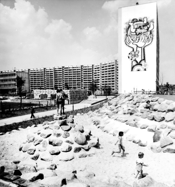
Fennpfuhl, leisure areas in Area 1 on the other side of Leninallee, 1970s
A unique feature of the estate was the public art. This mural “Happiness and Peace for our Children” by Dieter Gantz and Rolf Schubert no longer exists.
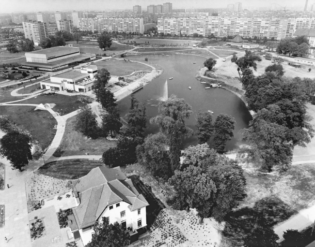
The heart of the estate: the water feature, 1987
Important items came to Leninallee from far and wide. In addition to shopping centres, kindergartens, schools, swimming pools, sports halls and a polyclinic, there were also restaurants such as the “Seeterrasse” situated in the middle of the estate by the water. It was demolished in 2008.
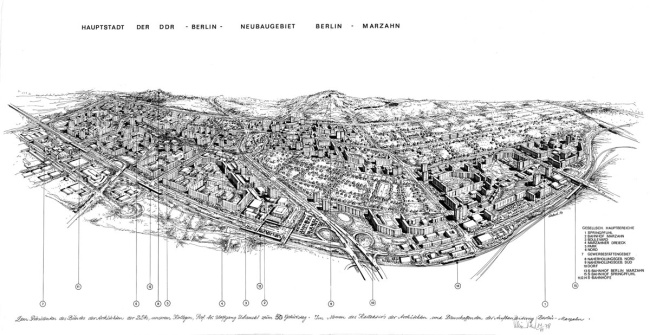
Drawing of the new Marzahn neighbourhood, 1978
In the 1970s, Leninallee was moved so it would no longer bisect the old village of Marzahn. High-rise buildings of up to 25 storeys are common in the vast Marzahn housing estate built to the north of the avenue.
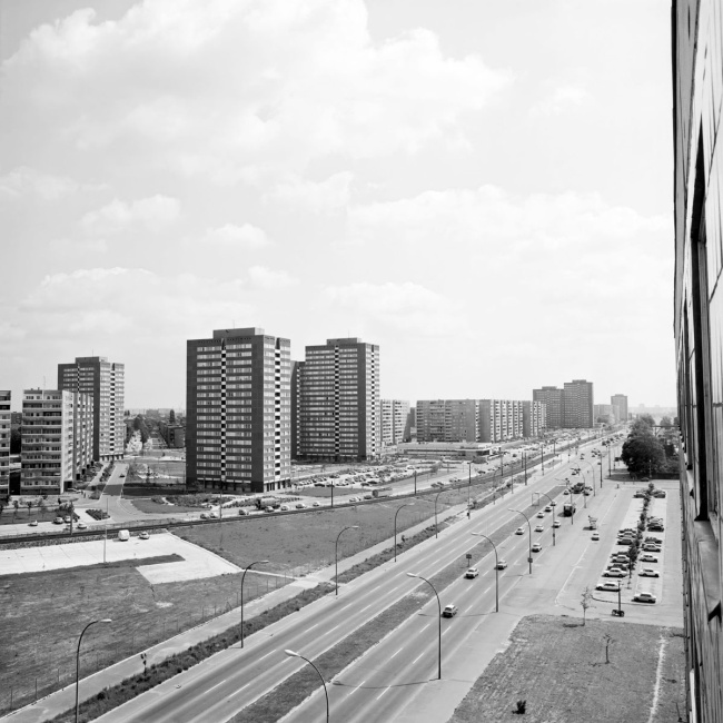
New housing estates on Leninallee in Lichtenberg, 1983
From 1977 to 1983, several residential blocks were built opposite the Lichtenberg pumping station between Altenhofer Strasse and Zechliner Strasse. They are situated quite some way from Leninallee.
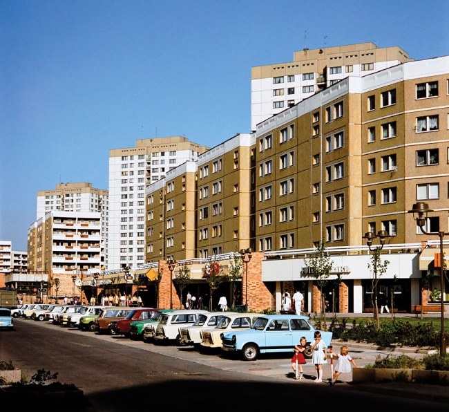
Marzahn Promenade with a parade of Lada, Wartburg and Trabant cars, 1986
The Promenade at the heart of Marzahn was separated from Leninallee by a row of houses. It was built between 1979 and 1990 according to plans by architect Wolf-Rüdiger Eisentraut, and featured a department store, leisure facilities and shopping centre. The post office and department store were demolished and replaced by the Eastgate shopping mall in 2005.
Tram and Trabant. Transport Planning in the GDR
Prioritising mass public transport over private transport and minimising transit through residential areas were the key objectives for transport planning in the GDR. In contrast to West Berlin, East Berlin always had an extensive tram network in addition to S-Bahn and underground railway lines. Nevertheless, the core features of automotive infrastructure remained, with multi-lane roads, tunnels, city motorways and the selective decommissioning of trams. For example, Leninallee was primarily geared towards car and bus traffic.
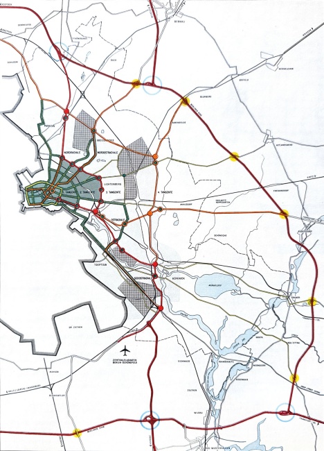
Plan of the main road network, East Berlin, 1969
The GDR's general transport plan envisaged a system of connecting radial and tangential roads. The radials were to lead traffic into the city centre, whilst the tangents were to lead it around.
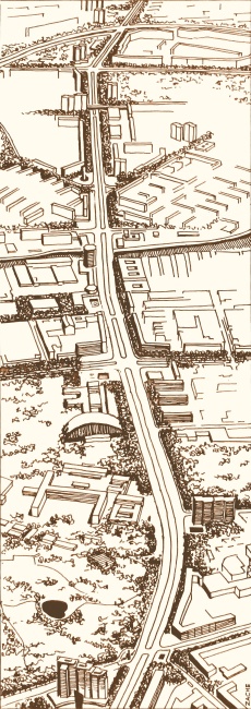
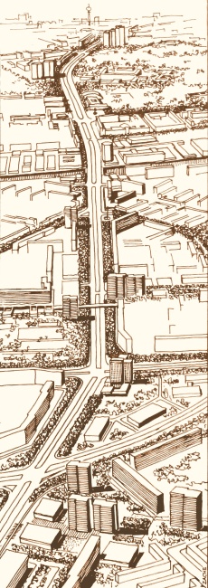
Proposals for improving the design of Leninallee’s main thoroughfare, 1975
Large prominent buildings were placed to provide orientation for drivers: the residential buildings on Leninplatz, the SEZ sport and recreation centre, and the Fennpfuhl and Marzahn housing estates. The proposals were drawn up by Manfred Zache, among others, on behalf of the Ministry of Construction and the Berlin City Council.
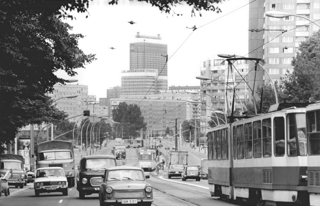
View across Leninallee to Alexanderplatz, 1980
As seen from Friedrichshain Hospital, cars and trams share the same lanes on Leninallee. Tram and car traffic are only separated from each other outside the S-Bahn ring.
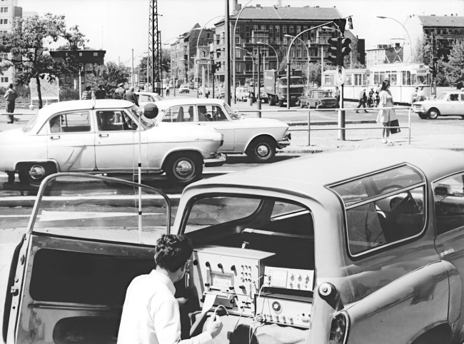
Measuring noise at a junction on Leninallee, 1976
According to a resolution of the Ninth Party Congress of the SED in 1976, noise pollution in residential areas needed to be reduced. To facilitate a more accurate assessment, noise measurements were carried out, such as this one at the junction of Bersarinstrasse/Leninallee (now Petersburger Strasse/Landsberger Allee).
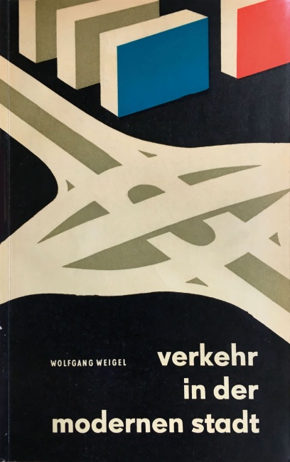
Forever modern! So too in the GDR: “Transport in the modern city”, 1962
Wolfgang Weigel: “The mastery of tomorrow’s motorisation requires a new, safe and efficient kind of road – the free-flowing thoroughfare. [...] Therefore these new main roads will be dedicated only for motor vehicle traffic, so that they can develop into motorways, depending on the size of the city.”
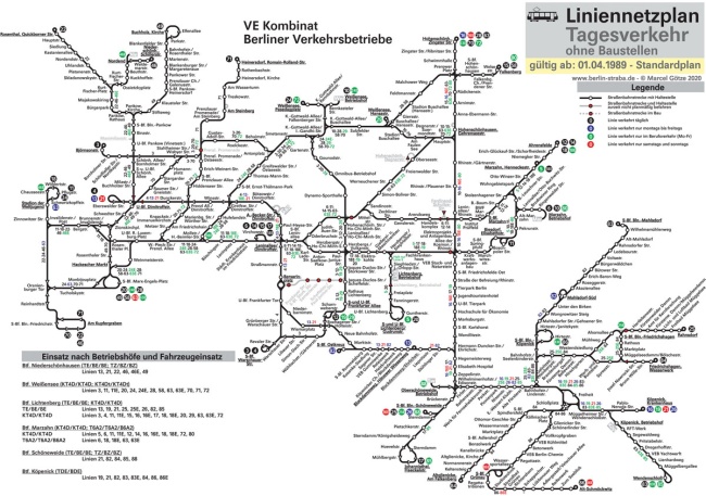
East Berlin tram network, 1989
Trams were decommissioned in the East Berlin areas of Mitte and Treptow. However, the massive expansion of the network into the new residential areas in the north-east of the city are still evident today.
After 1989: an American Avenue?
In 1992, Leninallee became Landsberger Allee – and a shopping destination. This led to its being referred to as the “most American of Berlin’s streets” (“taz”, 2002).
Kaufpark Eiche (1994) on the outskirts of Berlin was soon joined by other shopping centres such as Allee-Center (1994), Forum Landsberger Allee (1996), Castello Kiez Center (2000) and Eastgate (2005). This was swiftly followed by furniture shops such as Möbel Max (1994-2014), Ikea (2010), Globus (2011), and Möbel Höffner (2017). The road is currently undergoing further developments to make it more car friendly. Lesser known is the fact that the road also serves as a main artery of Berlin’s water supply, which is expected to be completely renovated by 2029.
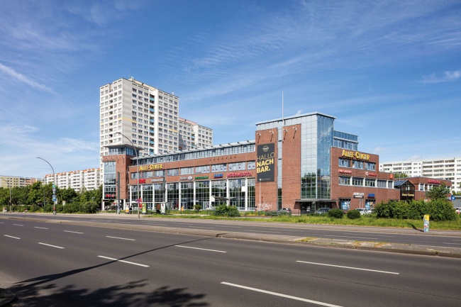
The Allee-Center, 2024
One of the first shopping centres along Landsberger Allee, the Allee-Center opened in 1994 with shops, a medical centre, restaurants and a multi-storey car park.
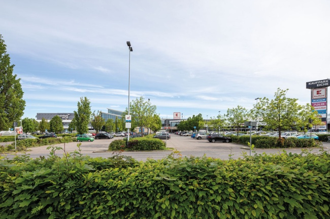
Kaufpark Eiche, 2024
Kaufpark Eiche was built in 1994 just outside the Berlin city limits on Landsberger Chaussee. The specialist retail park with grocery stores and around 4,000 parking spaces was intended to supply the large housing estates of Marzahn and Hellersdorf.
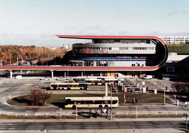
The Eastgate shopping centre, 2006
The department store at Marzahner Tor, built in 1987, was demolished. The Eastgate shopping centre opened in its place in 2005.
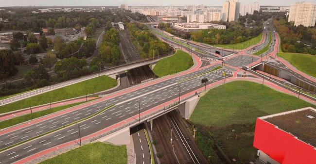
Rendering of the bridge junctions 2 and 3 at the Marzahn intersection, 2024
Marzahn intersection connects Landsberger Allee and Märkische Allee together with the mainline and S-bahn railway lines. By 2029 the old interchanges are to be rebuilt, while the pedestrian tunnel will be repaired and renewed.
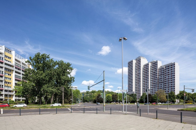
The Platz der Vereinten Nationen intersection, 2024
Car and tram routes travelling from Alexanderplatz and Strausberger Platz all overlap at the Platz der Vereinten Nationen.
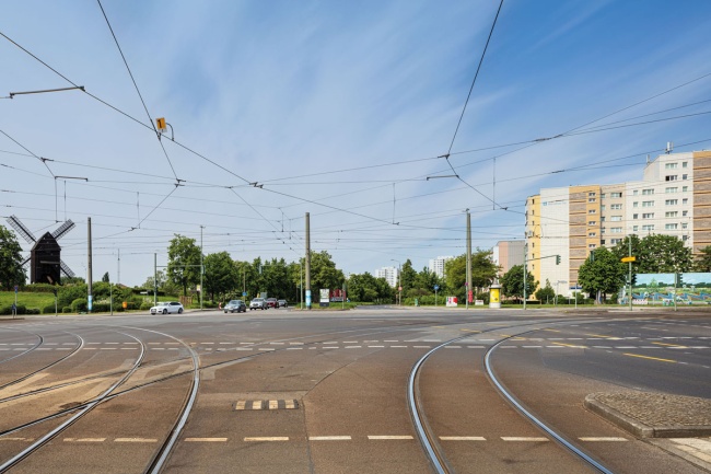
Landsberger Allee in Marzahn, 2024
At its Berlin end, Landsberger Allee separates the large housing estate at Marzahn and the village of Alt-Marzahn from the Bock windmill.
Key Figures
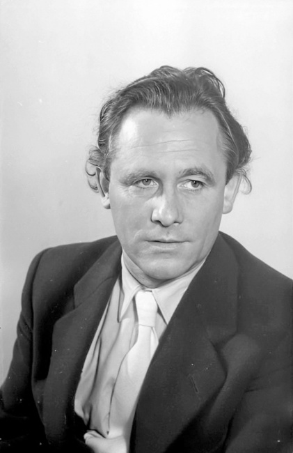
Hermann Henselmann (1905–1995)
Leninplatz was developed between 1968-1970 based on a design by architect Hermann Henselmann and collectives from the Bauakademie of the GDR. Henselmann further influenced the design of East Berlin as chief architect for the Magistrate of Berlin (1954-1959).
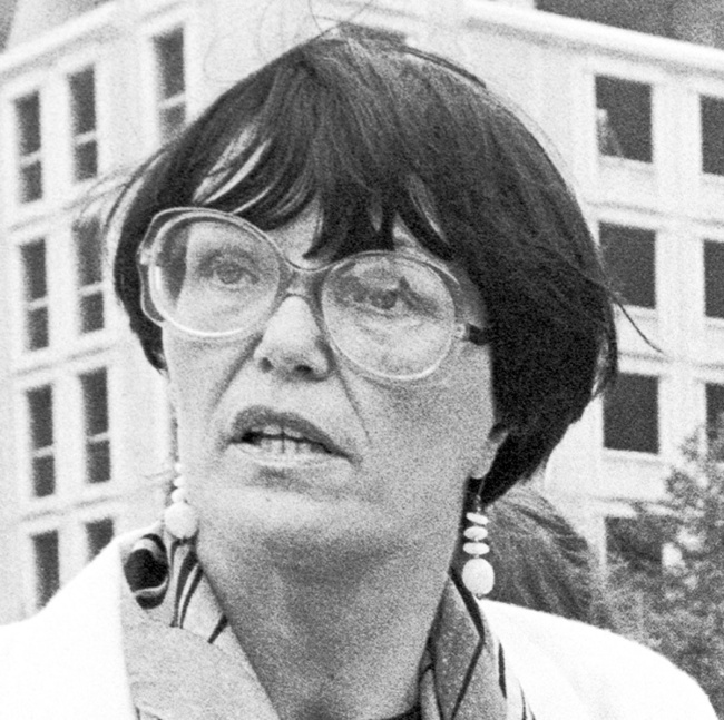
Dorothea Krause (1935–2024)
The architect worked as a city planner in the urban planning office of the Berlin city council. She played a key role in the planning of the former Lichtenberg Nordost industrial complex, which is now known as “Berlin Eastside”.
Gerhard Jung (geb. 1929)
The engineer was Head of the Department of Transport, Roads and Water Management (1967–1970) and City Councillor for Transport and Communications (1975-1978) in the Berlin City Council. He was responsible for the expansion of transport networks and transport planning for personal and commuter traffic.
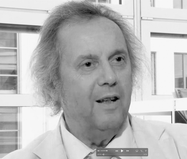
Wolf-Rüdiger Eisentraut (geb. 1943)
The architect designed the main urban development for Marzahn town centre, including the railway station, department stores, cultural centre, promenade, indoor swimming pool, and town hall (1979–1990). He was also involved in the construction of the Palace of the Republic (1976) and the “Seeterrassen” restaurant in Fennpfuhl (1985).