Köpenick: Schloßplatz
HILMER SATTLER ARCHITEKTEN
The Riverside Park
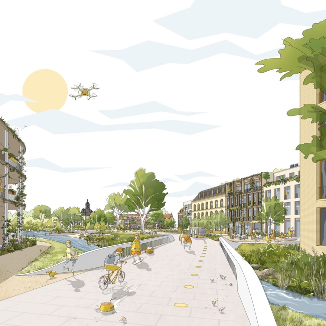
The historic layout of the area between the southern part of Köpenick‘s old town and the Schloss (palace) as well as the adjoining area to the east up to Kietzer Graben has been completely changed by the car-friendly expansion of Müggelheimer Straße. Our proposal revises this dissatisfying situation in several places: both on the south-eastern side of Schloßplatz and on the northern side of the planned riverside park, there will be an appropriately scaled, complementary building development (residential and commercial), whereby the square and park, enlivened by pedestrians, cyclists, and tram transfer passengers, can be experienced again. Car traffic, which will be significantly reduced in future, will be channelled via Grünstrasse. Along the riverbank an attractive meeting place for recreation, sport and gastronomy will be created: the Uferpark am Schloss (the riverside park).
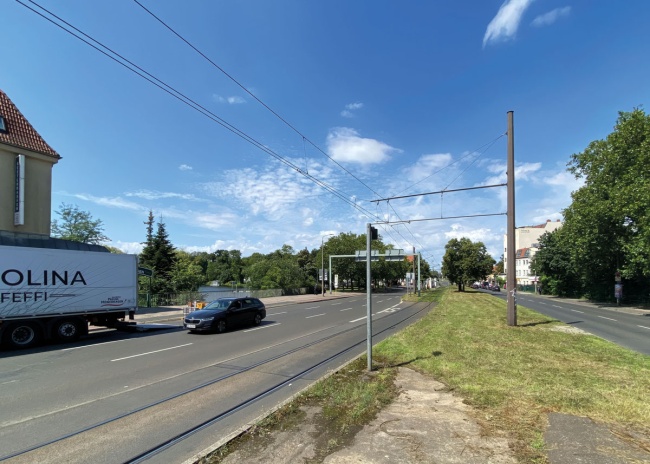
The existing street space
Around 1980, radical changes were made to the street layout: Müggelheimer Strasse became a four-lane thoroughfare travelling east to west, reshaping Schloßplatz and the back buildings along Grünstrasse. Only a 25 to 30 metre-wide strip of riverbank was made publicly accessible, hosting a single small restaurant and a boat hire station, giving an idea of the untapped potential of this cut-off resource.
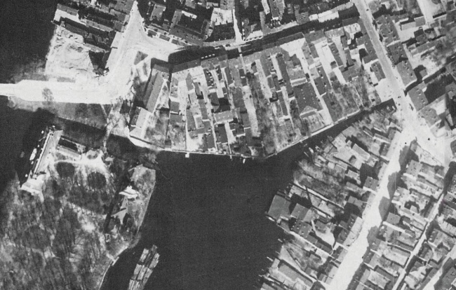
Aerial photograph, 1928
Koepenick’s old town and the Renaissance hunting lodge (1677-1685) are each located on an island in the confluence of the Dahme and Müggelspree rivers. This aerial photograph from 1928 shows the small parcelling of land with its many farm buildings and alleys. The town faces away from the water. The Schloss and its island are only visible from Schloßplatz and the Long Bridge.
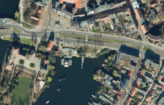
Aerial photograph, 2024
In the 1970s, this four-lane thoroughfare was developed to accommodate increasing car, bus and tram traffic. The widened Müggelheimer Strasse connects the suburbs with the centre of Berlin via the new Frauentogbrücke and Long Bridge. As a result of this development, the southern area of the old town was remodelled, whereupon the connection between the historic centre and Schloss island was destroyed.
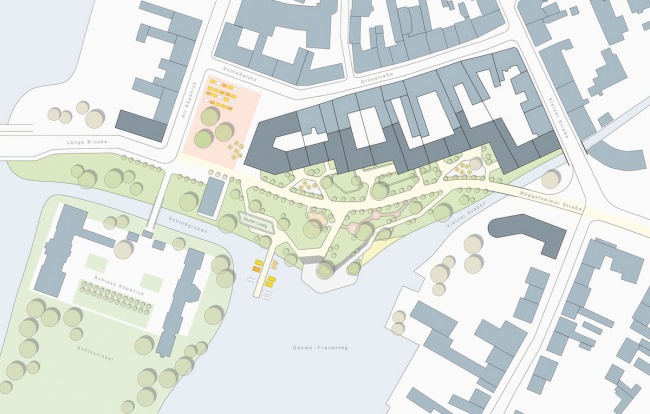
Site plan, 2070
The aim is to make Müggelheimer Strasse accessible solely for pedestrian and cycle traffic, and to create a multifunctional landscaped area, with spaces for activities and rest, planted lawns and ones for sunbathing, clusters of trees and areas for rainwater drainage. We are also proposing to frame the area with a development following the historic layout of the plots. The shoreline will feature steps for seating, a sandy beach, jetty and pontoons, as well as naturally left areas.
The riverside park
View across the Kietzer Graben and the new riverside park towards Schlossinsel island and Schloßplatz square.
The team
Hilmer Sattler Architekten, established in 1974, is guided by the fundamental recurring forms of architecture and urban planning. “We design and develop houses and cities, drawing as much as possible on their respective contexts. In our works we put individuality and diversity, proportion and precision in detail, the human scale and the need of community in public space on centre stage.”